Les Monts de Vaucluse
Le Vaucluse
The Monts de Vaucluse are a mountain range of the Southern Alps, in the departments of Vaucluse and Alpes-de-Haute-Provence, Provence.
The villages of Monts de Vaucluse :
Apt - Beaumettes - Cabrières-d'Avignon - Caseneuve - Fontaine-de-Vaucluse - Gargas -Gignac - Gordes - Goult - Joucas - La Roque-sur-Pernes -Lagnes - Le Beaucet - Lioux - L'Isle-sur-la-Sorgue - Méthamis - Murs - Oppedette - Pernes-les-Fontaines - Roussillon - Rustrel - Saint-Didier - La Roque sur Pernes - Saint-Pantaléon - Saint-Saturnin-lès-Apt - Saumane-de-Vaucluse - Velleron - Venasque - Viens - Villars... mais il faut aussi ajouter diverses communes ou parties de communes comme : Aurel - Le Beaucet - Monieux - Saint-Christol - Sault - Saint-jean de Sault ...
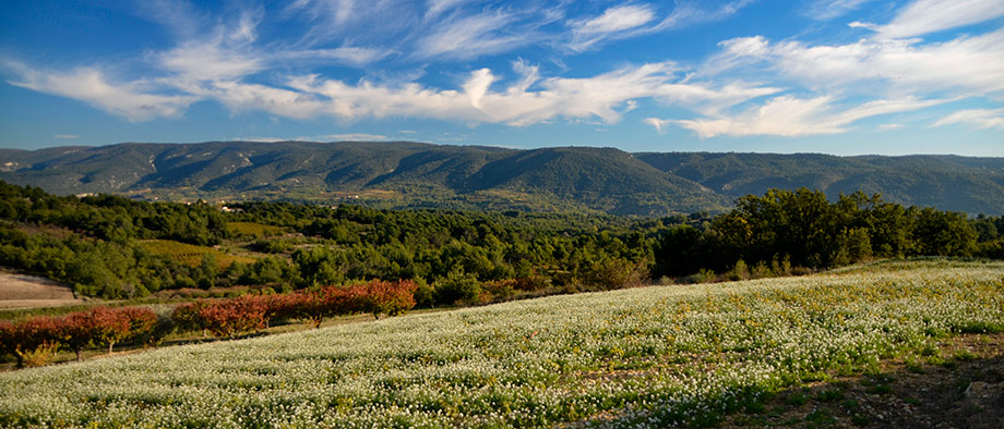
The Massif des Monts de Vaucluse is oriented east-west, extends North as Toulourenc and Jabron, south by the Calavon valley and beyond theLuberon to the west and northwest by the plain of Comtat Venaissin and east almost to the Durance . The northern part is formed by the links of theMont Ventoux - culminating with the massive 1,912 meters above sea level - and Lure (1827 m), separated by the Albion Plateau (1393 m). The eastern part is a mid-altitude plateau that ranges between 800 and 1,000 meters and peaks in signal St. Peter in 1256 meters altitude. The western part consists of members, since the region Sault until towards the plain. The altitude varies between 300 m and 1000 m. The Dentelles (755 m) west of theMont Ventoux , the Luberon Regional Nature Park extends to the southern part of the massif.
Geology and Hydrography
La Combe de Lioux , parallel to that of Vaumale. The massif is formed of limestone from the Mesozoic era, often permeable. The water sinks into the rock, creating underground networks (karst system), standing at low points as the Fontaine-de-Vaucluse . There are many potholes, that of Saint-Christol Blower (795 meters) of the Caladaïre near Montsalier (667 meters), and the Aven Autran (647 meters) Saint-Christol , are among the deepest in Vaucluse, net 72,660 ha2 is advanced with an afforestation rate of 40%